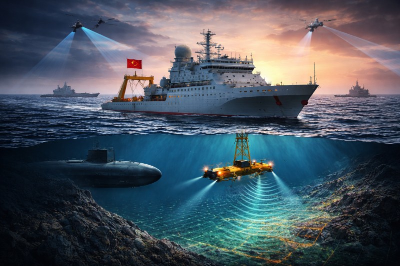
Naval experts say this effort could play a critical role in future submarine warfare, particularly in a potential conflict with the US and its allies.
One of the key vessels involved is the Dong Fang Hong 3, operated by the Ocean University of China.
Ship-tracking data shows the vessel conducted repeated missions between 2024 and 2025 near Taiwan, Guam, and across strategic waters in the Indian Ocean.
It also surveyed routes near Sri Lanka and Indonesia, including approaches to the critical Malacca Strait.
While Chinese authorities describe these missions as scientific research, including climate studies and seabed analysis, experts say the data gathered has clear military relevance.
Strategic value of seabed data
Deep-sea mapping allows submarines to navigate safely, avoid detection and operate more effectively.
It also supports anti-submarine warfare by improving the ability to track adversary vessels.
Experts note that underwater terrain, temperature, salinity and currents directly affect sonar performance and sound propagation.
These factors determine how submarines are detected and how effectively they can remain hidden.
According to analysts, the scale of China’s data collection suggests preparation for advanced submarine operations.
The information gathered could help Chinese forces deploy submarines more efficiently while identifying vulnerabilities in rival fleets.
A network of vessels and sensors
The Dong Fang Hong 3 operates as part of a much larger network.
Investigations show that dozens of research vessels and hundreds of sensors are involved in China’s undersea mapping effort.
Tracking data from multiple ships reveals systematic seabed surveys across vast ocean regions.
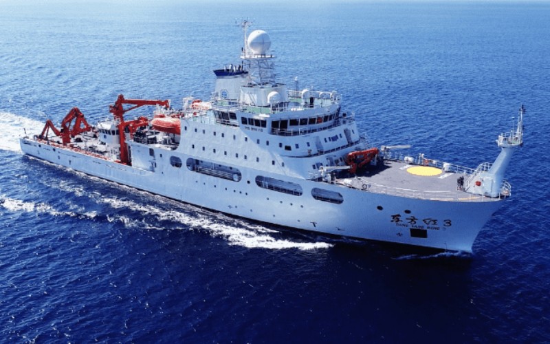 Chinese new-generation research vessel, Dong Fang Hong 3. Photo: Ocean University of China
Several vessels have conducted direct mapping, while others carry specialised equipment for underwater data collection.
These operations focus on strategically sensitive areas, including waters near the Philippines, Hawaii, and Wake Island.
These regions host key US military facilities and are central to Indo-Pacific security dynamics.
Civil-military fusion in maritime strategy
China’s ocean research programme reflects a broader policy known as “civil-military fusion”, promoted under Xi Jinping.
This approach integrates civilian scientific research with military objectives.
Many of the vessels involved are operated by state institutions or affiliated research organisations.
These entities often collaborate with defence establishments, allowing scientific data to feed directly into military planning.
Experts say that even research conducted for commercial or environmental purposes can serve dual-use functions, contributing to naval intelligence and operational readiness.
Focus on 'First Island Chain'
A significant portion of China’s mapping activity concentrates around the so-called First Island Chain, a strategic arc stretching from Japan through Taiwan to Southeast Asia.
This region acts as a natural barrier limiting China’s access to the Pacific Ocean.
Analysts say Beijing’s detailed mapping efforts indicate a desire to better understand and potentially overcome this constraint.
Waters surrounding Japan, the Philippine Sea, and areas east of Taiwan have seen intensive survey activity.
These zones are considered critical for any future naval confrontation involving submarines.
Extending reach to Indian Ocean and Arctic
China’s mapping operations extend well beyond East Asia.
Large sections of the Indian Ocean have been surveyed, reflecting the region’s importance for energy imports and trade routes.
The country depends heavily on maritime routes passing through the Malacca Strait, making undersea knowledge in this region strategically valuable.
Surveys near key underwater features, including long ocean ridges, further enhance navigational and operational capabilities.
In the Arctic, Chinese vessels have mapped seabed areas near Alaska, aligning with Beijing’s ambition to expand its presence in polar regions.
Building a ‘transparent ocean’
A major component of China’s strategy is the development of a “transparent ocean” system, designed to provide continuous monitoring of underwater conditions.
This involves deploying networks of sensors, buoys and subsea arrays across critical maritime zones.
Initial deployment began in the South China Sea, where China has established extensive observation systems.
The network has since expanded into the wider Pacific and Indian oceans.
These systems collect data on water temperature, salinity and movement, which can enhance sonar performance and enable long-term tracking of submarine activity.
Implications for naval balance
China’s growing undersea capabilities are drawing attention from military analysts and officials.
Data collected through mapping and monitoring can support submarine navigation, concealment and targeting.
The scale of these efforts suggests a shift in maritime dynamics, particularly in regions where US naval forces have traditionally held an advantage.
With extensive seabed knowledge and sensor networks, China is building a more comprehensive understanding of the underwater battlespace, which could influence future naval operations across multiple theatres.